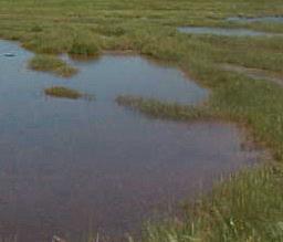


Tidal marshes form in low-lying coastal areas that are sheltered from strong winds, waves, and currents. Nourished by tidal flows and with rapidly growing grasses, salt marshes form the basis of a highly productive food web. They are complex natural systems which support different plants and animals in a variety of habitats.
PARTNERS
|
Tidal marshes are highly productive ecosystems, providing breeding and feeding habitat for numerous plants and animals. The Scarborough Marsh is a regionally significant resource.
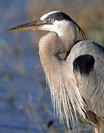
72% of water-dependent birds identified statewide were found at Scarborough Marsh, according to Maines Department of Inland Fisheries and Wildlife; furthermore, recent statewide surveys by MDIFW biologists at 53 salt marshes indicate that Scarborough Marsh has the highest diversity of water-dependent bird species found in any of Maines salt marshes.
The USFWS confirms that the marsh provides high value habitat for 27 endangered, threatened, rare or declining bird species in Southern Maine and that all 43 species of endangered, threatened, declining, and/or rare trust resources (including both plants and animals) inhabiting coastal Southern Maine. The marsh plays a key role in the recovery of peregrine falcons and bald eagles which visit the marsh to forage and rest.
Scarborough Marsh is located within 1.5 miles of two nationally significant seabird nesting islands, including Stratton Island just off Prouts Neck, several beaches which support breeding birds, and several sizable parcels of land owned and protected by the Scarborough Land Conservation Trust. Nesting roseate terns from Stratton Island, which plays an important role in the survival of nearly all roseate terns in the Northeast, forage for food in the Marsh. Because Scarborough Marsh provides documented foraging habitat for piping plovers and least terns, it has been designated essential habitat for these endangered shorebirds.
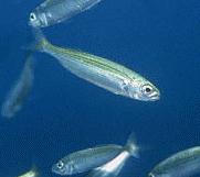
Scarborough Marshs tidal rivers and streams, salt marsh, pannes, and mudflats support commercially, recreationally, and /or ecologically valuable fish and shellfish including soft-shelled clams, sea worms, alewives, striped bass, smelt, sea run brook trout, and eel. The marsh also protects high value habitat for shad, river herring - alewives, blue black herring, and winter flounder.
Tidal creeks and pannes in the high marsh provide habitat for silversides and mummichogs which are key prey species for waterfowl and wading birds. The Scarborough Marsh supports the greatest number of shorebird and wading bird species statewide. Biological surveys confirm that black duck, blue-winged and green-winged teal, and wood duck nest in the marsh area. The marsh is also an important seasonal habitat for migrating species, including the black duck which have declined dramatically.
The National Marine Fisheries Service has designated Saco Bay as essential fish habitat for Atlantic salmon; pollock; whiting; hake; winter, yellowtail, and windowpane flounder; American plaice; ocean pout; halibut; sea scallop; sea herring; bluefish; and mackerel. With five major tributaries, the Scarborough Marsh flows into Saco Bay, and the high concentrations of herring, hake, and sand lance in Saco Bay depend directly on the delivery of clean and nourishing waters from the marsh.
In the midst of a still developing landscape just south of Portland, Scarborough Marsh is Maine's largest and best known salt marsh. The 3,100 acre Scarborough Marsh Wildlife Management Area, owned and managed by the State of Maine, Department of Inland Fisheries and Wildlife, includes approximately 2,700 acres of salt marsh, five tidal rivers, several smaller streams, some coastal freshwater marsh, tidal flats, and less than 200 acres of upland habitat. 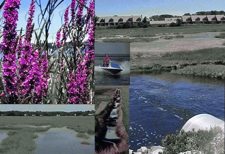
Challenges facing the Marsh today are largely the result of human activities occurring over a long period of time. Because of local and regional protection efforts, and the removal of tide gates, the marsh is many ways a healthier ecosystem now than 100 years ago. The effects of tidal flow restrictions, past fill, networks of ditches, farming, upland fringe fragmentation and habitat loss due to development, and polluted run off linger and compromise the biological vitality of the marsh. The Marsh remains at risk, as these harmful impacts have resulted in lowered salinity and reduced the amount of sediment available for marsh surface deposits or accretion. Invasive plant species such as Common Reed (Phragmites) and purple loosestrife have gained a foothold and continue to spread. Grid ditches excessively drained the high marsh and destroyed some of the permanent pool habitat that once supported a suite of species aquatic plants, invertebrates, fish, shorebirds, wading birds, and waterfowl. Personal Watercraft (a.k.a. jet skis) pose a greater threat than traditional watercraft, in part because as much as 25% of jet ski fuel is unspent and passed out as pollutants. Moreover, jet skis can go where traditional craft can not and therefore have greater access to and potential impacts on sensitive areas: places where people swim, habitats ideal for water birds to breed and raise young, quiet backwaters. Over the last 30 years, the Town of Scarborough has grown rapidly, with as many as 150-200 new homes being built annually. Undisturbed habitat is increasingly scarce particularly adjacent to the marsh. Residential and commercial development on the upland immediately surrounding Scarborough Marsh are an imminent threat to nationally significant fish and wildlife value in and near the marsh. It is difficult to overstate the threat of urban sprawl to fish and wildlife habitat in the Scarborough Marsh watershed. Permanently protecting remaining wetlands and upland buffer surrounding the Scarborough Marsh Wildlife Management Area and its tributaries is a high priority. Yet many of these impacts can be mitigated or corrected through restoration. For example, ditch-plugging involves pounding thick marine plywood into the existing man-made drainage ditches and surrounding the plywood with "spoil" from the marsh. Spoil is excavated from small pannes, which are designed with sloping sides to create foraging habitat for waterbirds. Ditch plugs prevent water from draining, allowing the water table to rise in the high marsh and restoring natural permanent panne habitat on the high marsh. Re-establishing permanent pools of water and restoring hydrology to the marsh benefits fish and wildlife and restores plant communities.
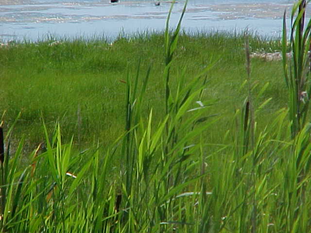
Phragmites australis, also known as common reed, is a perennial and aggressive wetland grass. Growing in dense stands of reeds over 10 feet tall, it is easily recognized by its height and distinctive fronds of fluffy seed heads, which turn from purplish in July, to brown, then gray by October. WHERE DOES PHRAGMITES GROW? Found in marshes and swamps, along streams, lakes, ponds, and ditches, Phragmites is most commonly associated with coastal brackish water, as well as disturbed, moist sites. Often found alongside roads, stands of the reed are easy to spoteven by motorists traveling quickly. More and more prevalent in Scarborough, Phragmites has become so common, many mistakenly believe it is the marsh. HOW DOES PHRAGMITES SPREAD? Often very difficult to eradicate, Phragmites is an aggressive species that rapidly colonizes new areas. Shoots and rhizomes grow from the nodes, spreading the plant far beyond its original bounds. Rhizomes may reach 10 meters or more in length, and in sparse stands, shoots that fall over become horizontal runners. WHY IS PHRAGMITES A PROBLEM? Phragmites can be an indicator that a wetland ecoysystem is out of balance. Disturbances or stresses such as pollution, alteration of the natural hydrologic regime, and increased sedimentation favor invasion and continued spread of Phragmites. Phragmites, which tends to grow in monospecific (one species) stands, out-competes other species. In contrast to beneficial wetland species, Phragmites provides little or no food or shelter value to wildlife. Phragmites itself becomes a greater and greater problem as the quality of our wetlands deteriorates.
|